The past, present, and future of the landscape – in 3D and virtual reality
The Center for Virtual Reality and Landscape Modeling, operating at the Department of Geography, is an interdisciplinary scientific, research, and educational facility that combines geography with modern digital technologies.
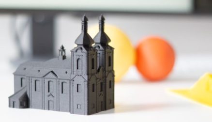
One of the center’s research areas is the application of geoinformation technologies, 3D graphics, virtual and augmented reality, and 3D printing in landscape research and planning.
Using these tools, we analyze, reconstruct, and visualize landscape processes and changes—both past and present, as well as possible futures.
Virtual modeling thus not only aids in the scientific understanding of space, but also serves as a means of popularizing geography and raising awareness in the field of sustainable landscape development.
🎥 Watch the video and take a look at one of the research projects that combine geography and advanced visualization technologies.